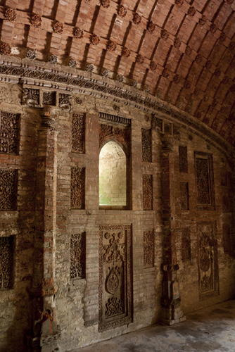
Saturday 9 March 2013

The Biodata


Name : Elias Bin Bujang
Matric No: A10A018
Faculty: Faculty of Entrepreneurship and Business
University : University Malaysia Kelantan
Date of Birth : 3 June1990
Place of Birth: Hospital Umum Miri, Sarawak
Area of Study: Bachelor of Tourism
Ambition: Businessmen
Evaluation of this assignment :
"this subject has helped me a lot in finding a new interesting in the world. besides that, its also has encourage me to know more about other interesting places in the world and its also motivate me to travel."

#1 Glacier Bay National Park


Location

The park is part of 24-million-acre block (37,500 square miles) of protected land, a World Heritage Site, that includes Wrangell-St. Elias National Park (the nation's largest) and Canada's Tatsenshini-Alsek Park and Canada's Kluane National Park.

Glacier Bay National Park, Wilderness and Preserve sits at the northern end of the Alaska Panhandle, stretching from Gustavuswest of Juneau north through one of the narrowest parts of the "pinch," where the state is narrowed down to about 20 miles from Mount Fairweather to the Gulf of Alaska, on to the Alsek River, one of the state's 26 national wild and scenic rivers and a favorite of rafters.

The park has a long bay, which has several smaller arms, and a share of the Gulf of Alaska coastline.


Attractions

Glaciers, orcas, bears, Alsek River rafting and rugged mountains.


Wildlife
Bears, eagles, sea lions, seals, sea otters, millions of birds.


Activities
Kayaking is a favorite activity in the park. Water taxis ferry kayakers and hikers from Gustavus and Bartlett Cove to deeper recesses in the park.


Weather / What to wear
It's probably going to rain. The weather will be cool, with midsummer highs in the low 60s. If it's sunny and warm, celebrate in one of the world's most beautiful places. On the longest day, the summer solstice, the sun will be above the horizon for 18 hours and 18 minutes.


How to get to Glacier Bay
Thousands of the park's visitors pass through on cruise ships. But if you're planning to stay awhile, you can head over on a water taxi or small plane from Juneau, 50 miles to the east. In early June 2004, Alaska Airlines will start its seasonal 737 jet service to Gustavus, putting the park just a hop, skip and puddlejump from Seattle, Juneau or Anchorage. There is no service from the Alaska Marine Highway ferry.

#2 Hawaii Volcanoes National Park


This site contains two of the most active volcanoes in the world, Mauna Loa (4,170 m high) and Kilauea (1,250 m high), both of which tower over the Pacific Ocean. Volcanic eruptions have created a constantly changing landscape, and the lava flows reveal surprising geological formations. Rare birds and endemic species can be found there, as well as forests of giant ferns.


Hawaii Volcanoes National Park contains Mauna Loa and Kilauea, two of the world’s most active and accessible volcanoes where ongoing geological processes are easily observed. This property serves as an excellent example of island building through volcanic processes. Through the process of shield-building volcanism, the park's landscape is one of relatively constant, dynamic change.

Criterion (viii) This property is a unique example of significant island building through ongoing volcanic processes. It represents the most recent activity in the continuing process of the geologic origin and change of the Hawaiian Archipelago. The park contains significant parts of two of the world's most active and best understood volcanoes, Kilauea and Mauna Loa. The volcano Mauna Loa, measured from the ocean floor, is the greatest volcanic mass on earth. The Hawaii Volcanoes National Park is greatest and the calderas of Kilauea are one of most studied in the world: in fact there is a geologic station dating from 1912.


#3 Terengganu State Museum


Acclaimed as the largest of its kind in Malaysia, the Terengganu State Museum houses century old artifacts and artworks of rich and colourful heritage. Located on 27 hectares of land in Bukit Losong, Kuala Terengganu, the complex itself is an impressive architectural feature, based on the ancient Terengganu palace designs and architectures. The complex’s many galleries showcase textiles, historical artifacts, crafts, royal regalia, Islamic arts, contemporary arts, weapons, petroleum development, historical, sea faring trade, fisheries and marine galleries.


Herbs and botanic garden is well-maintained in the vicinity of the museum. At the main entrance, the original Arabic Jawi text inscription of Islamic religious decree Inscribed Stone or “Batu Bersurat” of Terengganu is prominently displayed, which proves the earliest acceptance of Islamic teachings in the Malay Peninsula. The maritime complex, the restored original old palaces and traditional boats used by sea-faring locals are also prominently displayed in the compound.


Ticket fee:
New Ticket fee effective 1 January 2010 :

Malaysian Citizen
Adults - RM5.00
Children - RM2.00
                                                      Uniformed Student - RM1.00

                                                     
                                                      Non Citizen 
                                                      Adults - RM15.00
                                                      Children - RM10.00

How To Get Here

By Bus
The Heritage Town Bus plies daily routes around the City of Kuala Terengganu that include the State Museum. It is only a 15-20 minutes journey from the Bus Terminal in Dataran Shahbandar.

By Taxi or Car Rental
There are taxis on call from most hotel and resort in the city. Hotel Reception is able to assist in getting the taxi at the convenience of the guests. Taxis for hire are available from Kuala Terengganu Taxi Station. Most travel agents in the city provide car or van for rental at affordable rates.

From the city centre, follow Jalan Sultan Ismail route towards Jalan Hiliran until reaching the junction next to Chabang Tiga Wet Market. Turn right for another junction that takes a straight route towards the State Museum.


Where To Stay
  • Primula Beach Hotel
  • Permai Hotel Kuala Terengganu
  • Tanjung Vista Hotel
  • Hotel Grand Continental Kuala Terengganu
  • Hotel Seri Malaysia Kuala Terengganu

Where To Eat

  • Keropok Lekor Stall Losong
  • Cabang Tiga Weekend Market (Saturday)
  • Restaurant Selera Timur 2
  • Mardi Mohamad Restaurant

#4 Dinosaur Provincial Park


In addition to its particularly beautiful scenery, Dinosaur Provincial Park – located at the heart of the province of Alberta's badlands – contains some of the most important fossil discoveries ever made from the 'Age of Reptiles in particular about 35 species of dinosaur, dating back some 75 million years.


Dinosaur Provincial Park contains some of the most important fossil specimens discovered from the "Age of Dinosaurs" period of Earth's history.  The property is unmatched in terms of the number and variety of high quality specimens, over 60 of which represent more than 45 genera and 14 families of dinosaurs, which date back 75-77 million years.  The park contains exceptional riparian habitat features as well as "badlands" of outstanding aesthetic value.


Dinosaur Provincial Park is located in the Dry Mixedgrass Subregion of the Grassland Natural Region. This is the warmest and driest subregion in Alberta. Permanent streams are relatively rare, although the ones that do exist are deeply carved into the bedrock in some places. This was exposed Cretaceous shales and sandstones, creating extensive badlands, the largest in Canada.

#5 Old Bridge Area of the Old City of Mostar


The historic town of Mostar, spanning a deep valley of the Neretva River, developed in the 15th and 16th centuries as an Ottoman frontier town and during the Austro-Hungarian period in the 19th and 20th centuries. Mostar has long been known for its old Turkish houses and Old Bridge, Stari Most, after which it is named. In the 1990s conflict, however, most of the historic town and the Old Bridge, designed by the renowned architect Sinan, was destroyed. The Old Bridge was recently rebuilt and many of the edifices in the Old Town have been restored or rebuilt with the contribution of an international scientific committee established by UNESCO. The Old Bridge area, with its pre-Ottoman, eastern Ottoman, Mediterranean and western European architectural features, is an outstanding example of a multicultural urban settlement. The reconstructed Old Bridge and Old City of Mostar is a symbol of reconciliation, international co-operation and of the coexistence of diverse cultural, ethnic and religious communities.

Justification for Inscription
Criterion (vi): With the “renaissance” of the Old Bridge and its surroundings, the symbolic power and meaning of the City of Mostar - as an exceptional and universal symbol of coexistence of communities from diverse cultural, ethnic and religious backgrounds - has been reinforced and strengthened, underlining the unlimited efforts of human solidarity for peace and powerful co-operation in the face of overwhelming catastrophes.

Further information
The Old Bridge area of the Old City of Mostar, with its exceptional multicultural (pre-Ottoman, eastern Ottoman, Mediterranean and western European) architectural features, and satisfactory interrelationship with the landscape, is an outstanding example of a multicultural urban settlement. The qualities of the site's construction, after the extremely ravaging war damage and the subsequent works of renewal, have been confirmed by detailed scientific investigations. These have provided proof of exceptionally high technical refinement in the skill and quality of the ancient constructions, particularly of the Old Bridge. Of special significance is the Radoboija stream, which enters the Neretva on its right bank. This provided a source of water for the growing settlement, and from it springs a number of small canals used for irrigation and for driving the wheels of water-mills.


Little is known of Mostar in the medieval period, although the Christian basilicas of late antiquity continued in use. The name of Mostar is first mentioned in a document of 1474, taking its name from the bridge-keepers (mostari ); this refers to the existence of a wooden bridge from the market town on the left bank of the river which was used by soldiers, traders, and other travellers. At this time it was the seat of a kadiluk (district with a regional judge). Because it was on the trade route between the Adriatic and the mineral-rich regions of central Bosnia, the settlement spread to the right bank of the river. It became the leading town in the Sanjak of Herzegovina and, with the arrival of the Ottoman Turks from the east, the centre of Turkish rule.

The town was fortified between 1520 and 1566, and the bridge was rebuilt in stone. The second half of the 16th century and the early decades of the 17th century were the most important period in the development of Mostar. Religious and public buildings were constructed, concentrated on the left bank of the river, in a religious complex. At the same time many private and commercial buildings, organized in distinct quarters, known as mahalas (residential) and the bazaar, were erected.

#6 Historic Mosque City of Bagerhat


Situated in the suburbs of Bagerhat, at the meeting-point of the Ganges and Brahmaputra rivers, this ancient city, formerly known as Khalifatabad, was founded by the Turkish general Ulugh Khan Jahan in the 15th century. The city’s infrastructure reveals considerable technical skill and an exceptional number of mosques and early Islamic monuments, many built of brick, can be seen there.


The historic city of Khalifatabad is an outstanding example of an architectural ensemble which illustrates a significant stage in human history. Situated in the suburbs of Bagerhat, at the meeting point of the Ganges and Brahmaputra rivers, this ancient city was founded by the Turkish general Ulugh Khan Jahan in the 15th century. In this local capital of 50 km2 along the Bhairab River, 360 mosques, public buildings, mausoleums, bridges, roads, water tanks and other public buildings were built from baked brick. Shait Gumbad Mosque and Khan Jahan's Mausoleum are just two examples of these historic buildings.

Today this old city, created within a few years and swallowed up by the jungle after the death of its founder in 1459, is striking because of certain uncommon features. The density of Islamic religious monuments is explained by the piety of Khan Jahan, which is evidenced by the engraved inscription on his tomb. The lack of fortifications is attributable to the possibilities of retreat into the impenetrable swamps of the Sunderbans. The quality of the infrastructures - the supply and evacuation of water, the cisterns and reservoirs, the roads and bridges - all reveal a perfect mastery of the techniques of planning and a will towards spatial organization.

Today, the monuments, which have been partially disengaged from the vegetation, may be divided in two principal zones: to the west around the Mosque of Shait Gumbad and to the east around the Mausoleum of Khan Jahan.
More than 50 monuments have been catalogued. These include the Mosque of Shait Gumbad renowned for its large prayer room, divided into seven longitudinal naves; the mosques of Singar, Bibi Begni and Chunakkola; the mosques of Reza Khoda, Zindavir and Ranvijoypur. All these monuments are threatened, owing to the extreme salinity of the soil and the atmosphere, made especially vulnerable because brick architecture predominates.